What is the best map for the South England Coast?
For comprehensive navigation, especially for hiking, Ordnance Survey (OS) Explorer paper maps (1:25,000 scale) are highly recommended. For driving and general town exploration, digital apps like Google Maps offer convenient turn-by-turn directions and real-time information. A combination of both provides the most robust mapping solution for US travelers.
How do I use Google Maps for UK coastal paths?
To use Google Maps for UK coastal paths, first download offline maps of your intended areas to ensure coverage without internet. Search for specific towns, attractions, or path segments. While Google Maps offers walking routes, it may lack the granular detail of dedicated hiking maps for very specific trails. Always cross-reference with local signage or a detailed paper map.
Are there specific requirements for mapping the South West Coast Path?
For the South West Coast Path, the primary requirement is detailed topographical maps, such as Ordnance Survey Explorer maps. These show all public rights of way, elevation, and key landmarks. While no official permit is required to use maps, understanding UK footpath etiquette and having appropriate navigational skills will greatly enhance your experience.
What is the cost of buying maps for the South England Coast?
The cost of individual Ordnance Survey paper maps for the South England Coast typically ranges from 9 to 15 US dollars per sheet. Digital map apps often have free basic versions, with premium features or subscriptions costing anywhere from a few dollars a month to an annual fee. Factor in these costs when planning your travel budget.
Where can a US traveler find reliable maps for the South England Coast?
US travelers can find reliable maps for the South England Coast through several channels. Purchase Ordnance Survey maps online via Amazon or specialized map retailers before your trip. In the UK, they are available in bookstores and outdoor shops. Digital maps are readily available via smartphone app stores.
How accurate are online maps for coastal areas in South England?
Online maps like Google Maps are generally accurate for main roads and populated areas of South England's coast. However, for intricate footpaths, remote sections of coastal trails, or rapidly changing coastal features due to erosion, dedicated topographical maps like Ordnance Survey provide superior accuracy and detail. Always exercise caution and use multiple sources if possible.
map South England Coast, UK coastal path maps, South West Coast Path navigation, England coastal walks mapping, best digital maps UK, how to use maps South England, cost of UK coastal maps, US guide South England maps, coastal trail maps England, free online maps UK coastDiscover essential mapping resources for navigating the stunning South England Coast, specifically tailored for United States travelers and local-guide users. This comprehensive guide helps you understand what types of maps are available, where to find them, and how to effectively use digital apps like Google Maps or traditional paper charts for your coastal adventure. Learn about choosing the right map for hiking the South West Coast Path, exploring charming seaside towns, or simply driving along scenic routes. We cover various options from free online resources to specialized Ordnance Survey maps, highlighting their utility, potential costs, and why a US tourist would benefit from detailed navigational information. Prepare for a seamless journey along England's picturesque southern shoreline with expert mapping advice.
- What are the best map apps for South England coastal driving? - For driving along the South England Coast, Google Maps and Apple Maps are highly effective. They offer turn-by-turn directions, real-time traffic updates, and points of interest searches. Downloading offline maps for your route is recommended to maintain navigation in areas with limited mobile signal, ensuring a smooth journey.
- Where can I get a paper map for the South England Coast Path? - Paper maps for the South England Coast Path, particularly the detailed Ordnance Survey (OS) Explorer series, are available from several sources. You can purchase them online via Amazon or specialized map retailers. In the UK, they are sold at bookstores, outdoor equipment shops, and tourist information centers along the coast.
- Is a GPS device necessary for mapping the South England Coast? - While not strictly necessary for most casual travelers, a dedicated GPS device can be beneficial for serious hikers on the South West Coast Path or in remote areas. Your smartphone's GPS capabilities are often sufficient, but a dedicated device may offer longer battery life and better signal in challenging terrain. Always carry a backup map.
- How do I plan a South England Coast road trip using maps? - To plan a South England Coast road trip, start by outlining your route with digital maps like Google Maps to identify key towns and attractions. Use the planning features to estimate driving times and distances. Then, cross-reference with paper maps for scenic routes or specific points of interest not clearly marked digitally. Download offline segments for your journey.
- What scale map is best for walking the South England Coast? - For walking the South England Coast, especially on trails like the South West Coast Path, a 1:25,000 scale map is best. Ordnance Survey Explorer maps provide this level of detail, showing footpaths, contours, and small features vital for navigation. This scale allows for clear visibility of terrain and route options.
- Are maps of the South England Coast accessible for people with disabilities? - Accessibility information on maps for the South England Coast varies. Digital maps may offer some accessibility features for navigation. For detailed information on accessible paths or facilities, it's best to consult local tourism boards or specialized accessibility guides. Ordnance Survey maps show terrain, which can help in assessing suitability for various mobility needs.
- Can I use a free app to navigate the entire South England Coast? - You can use free apps like Google Maps or OpenStreetMap for general navigation along much of the South England Coast. However, for navigating extensive hiking trails or very rural, remote sections, these free apps may lack the granular detail and reliability of specialized, paid maps like Ordnance Survey. Consider a hybrid approach for safety and accuracy.
Mapping the South England Coast for US Travelers
For United States citizens planning an unforgettable trip to the South England Coast, effective navigation is paramount. Whether you envision a leisurely drive through picturesque villages or an adventurous hike along the South West Coast Path, having the right map is crucial. This guide provides actionable advice on understanding, acquiring, and utilizing maps to enhance your UK coastal experience, ensuring you can find your way with confidence and ease.
The South England Coast offers a diverse landscape of dramatic cliffs, sandy beaches, historic towns, and vibrant cities. From Cornwall to Kent, each region presents unique navigational challenges and opportunities. Understanding the terrain and available mapping tools before you arrive will help you maximize your exploration time and discover hidden gems, all while staying on track with local guidance.
Our focus here is on practical, transactional information that empowers you to make informed decisions about your mapping needs. We address common US search queries, providing direct answers and step-by-step instructions to help you plan your journey along one of the most beautiful coastlines in the world.
Understanding Different Map Types for the South England Coast
When planning your route along the South England Coast, you will encounter several types of maps, each suited for different purposes. Digital maps, often accessed via smartphone apps, offer convenience and real-time updates. Google Maps, for instance, provides driving directions, public transport information, and walking routes, making it a popular choice for many US travelers. Its satellite imagery and street view features can be invaluable for pre-trip visualization and on-the-ground orientation.
Traditional paper maps, such as those produced by Ordnance Survey, are highly detailed and essential for serious hikers or those venturing into areas with limited cell service. These topographical maps show elevation contours, footpaths, national trails, and points of interest with exceptional accuracy. Many US local guides recommend carrying a physical map as a backup, especially when exploring remote sections of the South West Coast Path or other long-distance trails where digital signals may be unreliable.
Specialized maps may also include tourist-specific versions highlighting attractions, dining, and accommodation, or historical maps that offer a glimpse into the region's past. Combining digital and paper resources often provides the most robust navigational strategy, ensuring you are prepared for any situation along the South England Coast.
Choosing Your Map Type Digital Versus Paper
The choice between digital and paper maps largely depends on your travel style and intended activities. For city exploration and driving, digital map applications like Google Maps or Apple Maps are often sufficient. They offer turn-by-turn navigation, traffic updates, and the ability to search for nearby restaurants, hotels, or gas stations, which is highly convenient for US visitors. Remember to download offline maps if you anticipate areas with poor internet connectivity.
For extensive hiking or exploring rural areas, especially sections of the South West Coast Path, paper maps from Ordnance Survey (OS) are generally preferred. These maps are renowned for their detail, accuracy, and durability. They clearly mark public footpaths, bridleways, and open access land, which are critical for navigating legally and safely. OS Explorer maps at a 1:25,000 scale are ideal for walking, while OS Landranger maps at 1:50,000 are better for cycling or driving and cover a larger area.
Many experienced travelers and local guides from the US recommend a hybrid approach. Use digital maps for general navigation, searching for amenities, and planning, but carry a relevant paper map and a compass for detailed trail navigation, especially in areas where GPS signals can be weak or battery life is a concern. This ensures you always have a reliable way to find your bearings on the South England Coast.
How to Navigate with Maps on the South England Coast
Navigating the South England Coast with digital maps is generally straightforward. Before your trip, ensure your smartphone is equipped with relevant mapping apps and consider purchasing a local SIM card or an international data plan to avoid excessive roaming charges. Download offline maps for areas you plan to visit, which will save data and allow navigation without an internet connection. Practice using the zoom and pan features, and familiarize yourself with how to search for specific locations or points of interest.
When using paper maps, understanding the legend, scale, and contour lines is essential. The legend explains symbols for features like pubs, churches, car parks, and footpaths. The scale indicates the ratio between map distance and real-world distance, helping you estimate travel times. Contour lines show elevation changes, vital for assessing the difficulty of a hike. Always orient your map to the landscape using prominent features or a compass to ensure you are heading in the correct direction.
For the South West Coast Path, pay attention to the official waymarkers, which are acorn symbols that complement your map navigation. Always inform someone of your planned route if hiking alone, and carry essential gear like water, appropriate clothing, and a fully charged power bank for your devices. By combining map reading skills with common-sense safety practices, your journey along the South England Coast will be both enjoyable and secure.
Most Asked Questions About Mapping the South England Coast
What is the best type of map for hiking the South West Coast Path?
For hiking the South West Coast Path, Ordnance Survey OS Explorer maps are highly recommended. These 1:25,000 scale paper maps provide exceptional detail, showing footpaths, rights of way, contour lines, and essential landmarks. While digital apps are useful, a physical OS map serves as a crucial backup, especially in remote sections of the path where mobile signal may be limited or absent.
Can I rely solely on Google Maps for my trip to the South England Coast?
For driving and general city navigation along the South England Coast, Google Maps is largely reliable. However, for detailed hiking on coastal paths or exploring very rural areas, relying solely on Google Maps is not advised. It may lack the granular footpath detail of specialized maps like Ordnance Survey, and cell service can be intermittent. Always consider downloading offline maps or carrying a paper map as a backup.
Are there free mapping resources available for the South England Coast?
Yes, several free mapping resources are available. Google Maps and OpenStreetMap offer extensive coverage for general navigation. Many official tourism websites for regions like Cornwall or Dorset provide free downloadable maps highlighting attractions. For hiking, some trail organizations offer free route descriptions and basic maps online, though they may not have the detail of a paid Ordnance Survey map.
How much do specialized maps for the South England Coast cost?
Specialized paper maps, such as Ordnance Survey OS Explorer maps, typically cost between 9 and 15 US dollars per sheet. Each sheet covers a specific area, so you might need several for a longer trip along the entire South England Coast. Digital versions or subscriptions to mapping apps may have different pricing models, ranging from free basic versions to annual fees for premium features.
Where can I purchase maps for the South England Coast in the US or UK?
In the US, you can purchase Ordnance Survey maps from specialized outdoor recreation stores or online retailers like Amazon. In the UK, they are widely available at bookstores, outdoor shops, tourist information centers, and directly from the Ordnance Survey website. Digital maps are typically downloaded directly to your smartphone or tablet through app stores.
What are the requirements for using mapping apps effectively in England?
To use mapping apps effectively in England, ensure your smartphone has sufficient battery life, consider carrying a portable charger, and either activate an international data plan or purchase a local UK SIM card upon arrival. Downloading offline maps for your intended areas is also crucial to ensure uninterrupted navigation, especially where cell service might be spotty along the coast.
Are there any specific safety considerations when using maps on the South England Coast?
When using maps on the South England Coast, particularly for hiking, be aware of coastal erosion which can alter paths or make certain sections dangerous. Always stick to marked trails and be cautious near cliff edges. Ensure your map is current, and always have a fully charged phone for emergencies. For remote areas, inform someone of your route and expected return time.
South England Coast map options, how to map UK coastal walks, best digital maps for South England, paper maps for South West Coast Path, Google Maps for England coast, planning a trip with coastal maps, what to expect mapping South England, requirements for UK coastal navigation


South Riding England Map The Most Beautiful Motorcycle Routes In South South Coast East Os Maps . Map Of South England Coast South England Tourist Map WCCX Relief Map Of UK England South East . Map Of South Coast England Key Beaches Travel Routes MMO UKs South Coast To Benefit From Marine Planning 600x300 . South Coast Map United Kingdom HQXNO South Coast West Os Maps . South England Road Trip Map I M Just A Girl South England Road Trip Map 1440x665


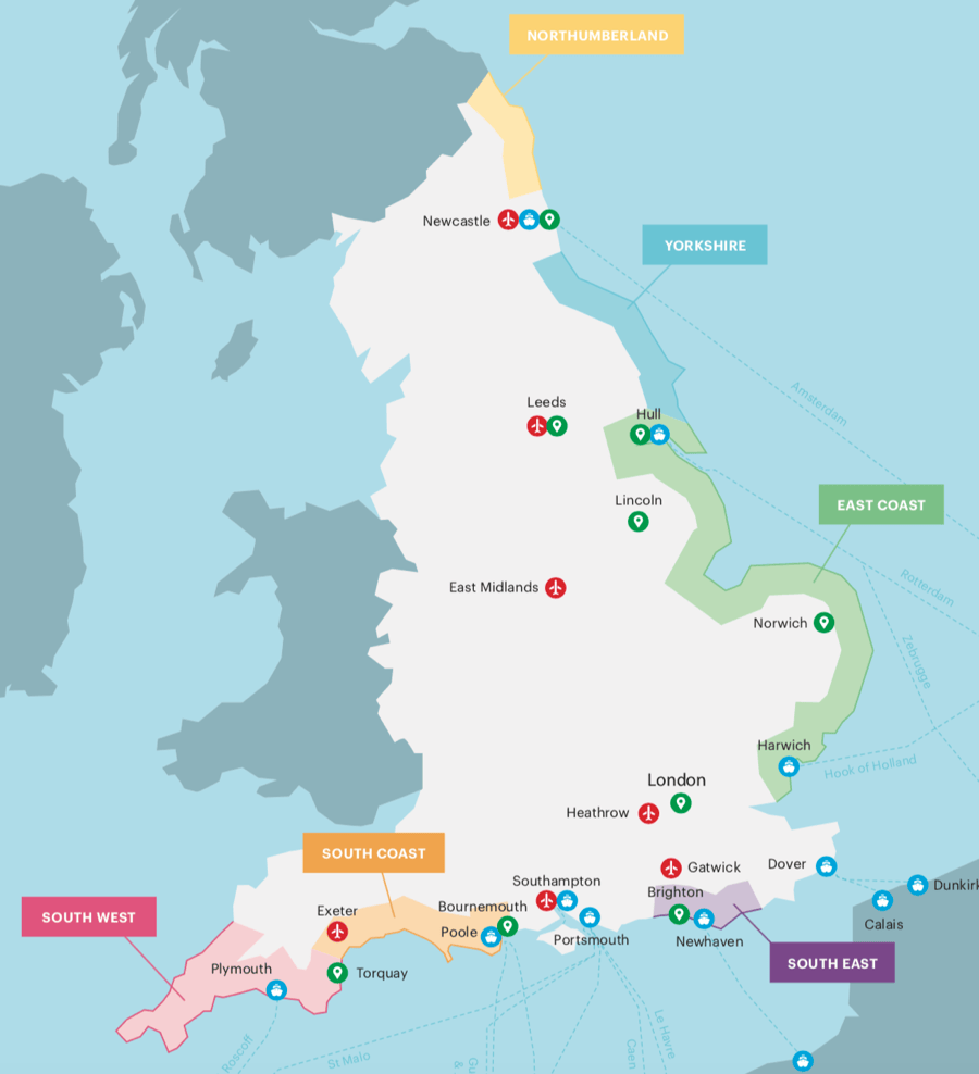

Great British Journeys Adeo Travel Tailor Made Tours Of England Map England Coast Country 2026 Scaled . Best 13 The Ultimate South Coast England Road Trip 2 Week Itinerary . South Coast England Road Trip 60 Photos Morilly Com England . England S Coast Launches Itinerary Creator Trip By Trip . A Map Of Southern England Showing Location Of Study Area B South A Map Of Southern England Showing Location Of Study Area B South Coast


Map Of England South Coast AFP CV Vv0BknMcnlj D. England Travel Maps Maps To Help You Plan Your England Vacation Kimkim Original . Best Guided Coast To Coast Walk In England For 2026 And Beyond Four AC UY218 . Maps Of Southern England Southern England COQP . Southern England 1. Map. Southern England


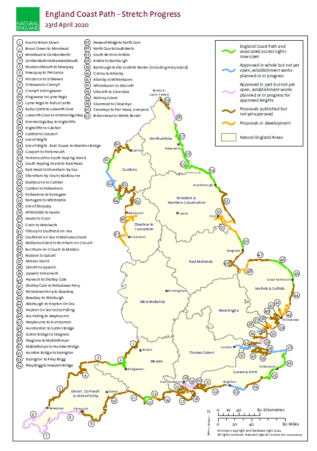
Vector South East England Map County Political Road And Rail Map 750k . Maps Of Southern England Southern England COQP . Map South England Guide To Coast Of South East England AC UF894,1000 QL80 . Digital Vector South East England Map With Strong Shaded Relief In 1 . The Proposed English Coast Path South Solent Protection Society Ne Coast Map
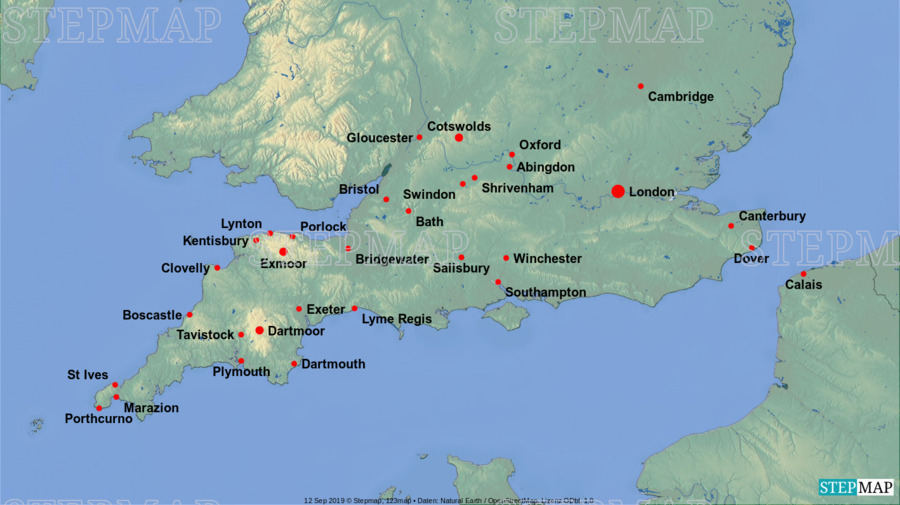
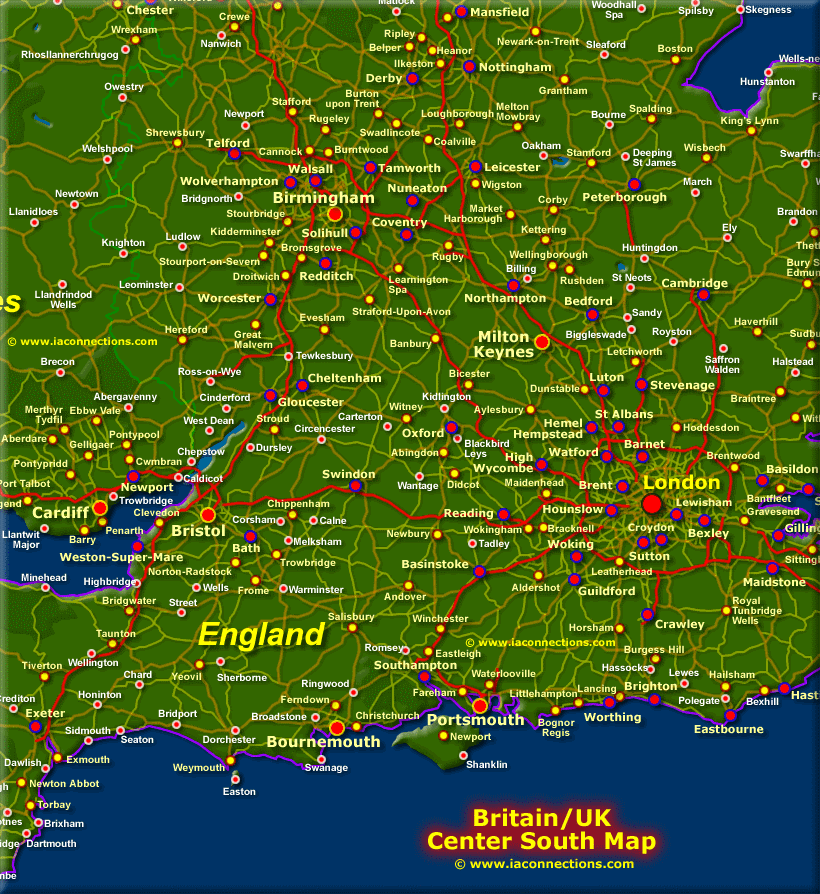


StepMap Southern England Landkarte F R England Southern England BsCbGcD38i . Top Tourist Attraction And Places Map Of South England Uk Tourist . The South Of England Physical Map I Love Maps 608x416 . The England Coast Path Book 1 The South Coast River Thames To River 263847 1 . South England Map South England Map PJYMXM 1200px South East England Map


Digital UK Simple County Map 5 000 000 Scale Royalty . Map Of English South Coast South Coast England Map VYPVHU New Route 2 Os Map . Navionics England South Coast Rowlands Marine Electronics Navionics England South Coast. Map Of South England Southern England Settlements Map OPJZQB . Southern England Escape With London 2026 Globus Tours 214133 .webp


.png)
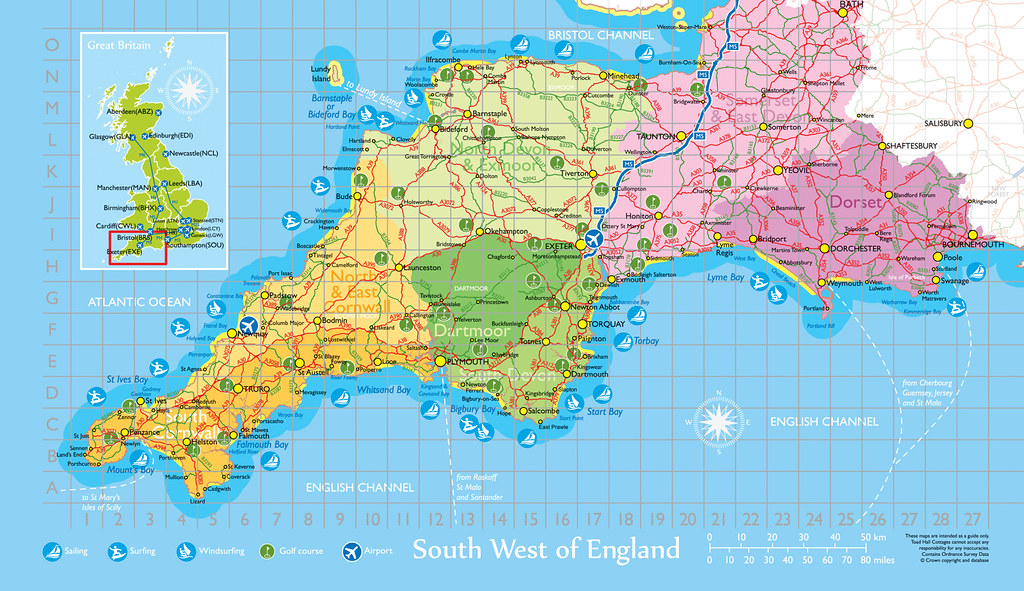

Maps South England AFP CV 1 . South Coast Map Of England Where To Go Jurassic Coast Dorset LALECU Map South East England . England Coast Path Walking Holidays Contours Walking Holidays South West Coast Path (2) . 00074 SW Map FLAT COL CR Map Of South West Of England For Flickr 7954411162 97f9f58a7d B . Detailed Map Of Cornwall England 736x665 Southern England Kent To Cornwall Special Road Map Choose Map Finish Printed On 190 Gsm Satin Finish Paper 23792 P