Discover the historical location of North Borneo through detailed maps, understanding its transformation into modern-day Sabah, Malaysia. For United States researchers, genealogists, and history enthusiasts, exploring a map of North Borneo offers a unique insight into Southeast Asian colonial history and geopolitical shifts. This guide helps you navigate historical cartography, pinpointing the former British protectorate's boundaries and how they relate to current regional maps. You will learn where to find accurate historical maps online and in archives, understanding their significance for academic study or personal exploration. We also cover crucial considerations when interpreting these antique maps, such as boundary changes, naming conventions, and the political landscape of the era. Whether you are tracing ancestral roots or simply curious about this captivating historical territory, our resources offer clear directions and reliable information. Find out why understanding the map of North Borneo remains essential for historical accuracy and geographical comprehension. This information is key for anyone researching Southeast Asia's past, providing valuable context for its present. Review available digital archives or local university map collections for availability near you or online access.
- What part of Borneo was called North Borneo? - North Borneo was the northernmost part of the island of Borneo, corresponding to present-day Sabah, a state in Malaysia. It was under British administration, first as a protectorate and then as a crown colony, distinct from other parts of the island governed by the Dutch or local sultanates.
- When did North Borneo become Sabah, Malaysia? - North Borneo officially became the state of Sabah within the Federation of Malaysia on September 16, 1963. This event marked the end of British colonial rule and its integration into the newly formed nation. Maps from before this date show it as North Borneo.
- Are old maps of North Borneo accurate for modern navigation? - While historically significant, old maps of North Borneo are generally not accurate for modern navigation. They lack current infrastructure, changed place names, and modern geographical precision. Always use up-to-date, specialized maps or GPS for any travel or navigation needs in the region today.
- What cities were prominent on a map of North Borneo? - Key cities on historical maps of North Borneo included Jesselton, which is now Kota Kinabalu, the capital of Sabah. Other important centers were Sandakan and Tawau. These cities served as administrative hubs and significant trading ports during the British colonial period.
- Why do historians study North Borneo maps? - Historians study North Borneo maps to understand colonial expansion, administrative divisions, economic development, and cultural interactions of the era. These maps serve as primary sources that reveal changes in land use, urban growth, and the impact of resource extraction on the region's environment and populace.
- Can I buy reproductions of North Borneo maps? - Yes, reproductions of historical North Borneo maps are available from various sources. Online historical map stores, specialized antique map dealers, and museum gift shops often offer prints. Ensure the reproduction quality is high and verify the original map's authenticity and date if historical accuracy is important.
- Is the map of North Borneo different from British Borneo? - Yes, the map of North Borneo refers specifically to the British North Borneo Protectorate/Crown Colony (present-day Sabah). British Borneo was a broader term encompassing all British territories on the island, including North Borneo, Sarawak (another crown colony), and Brunei (a protectorate), each with its own distinct governance.
What is the modern name for North Borneo?
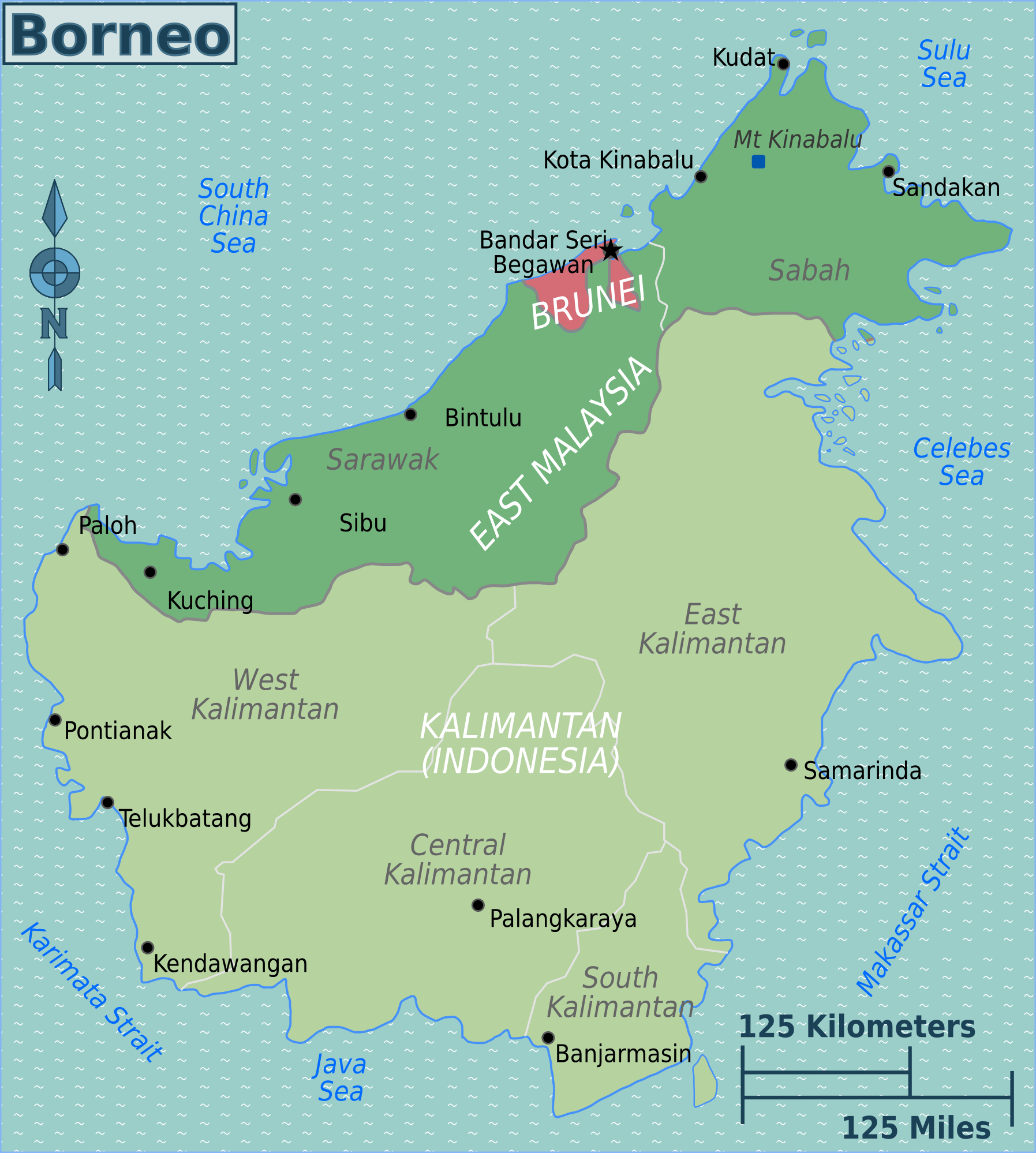
The territory historically known as North Borneo is now the Malaysian state of Sabah. This state occupies the northern part of the island of Borneo. When viewing contemporary maps, look for Sabah to find the modern equivalent of the former British protectorate and crown colony, which joined Malaysia in 1963.
Why are historical maps of North Borneo important?
Historical maps of North Borneo offer vital insights into colonial history, geopolitical changes, and regional development in Southeast Asia. They help researchers understand past administrative boundaries, resource distribution, and the evolution of towns. These maps are crucial primary sources for academic study, genealogy, and appreciating the region's complex past.
Where can I find maps of North Borneo in the U.S.?
You can find maps of North Borneo in major U.S. university libraries with strong Southeast Asian collections, such as the Library of Congress. Many digital archives and specialized cartography websites also provide high-resolution scans of historical maps. Always verify the source and date for accuracy and context.
What should I look for on an old North Borneo map?
When examining an old North Borneo map, observe the date, the cartographer, and the specific place names. Note how administrative boundaries are depicted and identify major towns like Jesselton or Sandakan. Compare these historical details with modern maps to understand changes in geography and nomenclature over time, ensuring accurate interpretation.
Did North Borneo ever exist as an independent country?
No, North Borneo was never an independent country in the modern sense. It existed as a British protectorate and later a British Crown Colony. In 1963, it gained self-governance before joining the Federation of Malaysia, becoming the state of Sabah. Its status was always tied to either British colonial rule or the larger Malaysian federation.
Where is North Borneo Located on a Map Today?Many people searching for a map of North Borneo often seek to understand a historical entity rather than a current nation. North Borneo existed as a British protectorate and later a crown colony, playing a significant role in Southeast Asian history. Its boundaries and political status evolved considerably before it became part of modern-day Malaysia. Understanding this history is crucial when attempting to locate it on any map.
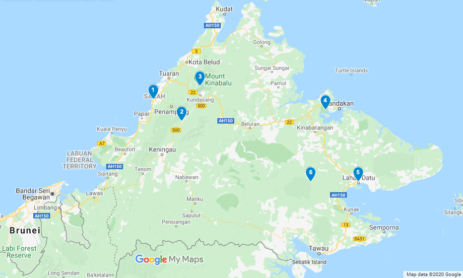
Today, the territory once known as North Borneo corresponds almost entirely with the Malaysian state of Sabah. This state occupies the northern portion of the island of Borneo, one of the world's largest islands. When you look at a contemporary map of Southeast Asia, you'll find Sabah clearly marked, revealing the modern geographical context of this historically important region.
Historical maps provide an irreplaceable window into the past, showing political divisions and geographical features as they were perceived and defined at various times. For anyone interested in the complex history of Southeast Asia, especially its colonial era, consulting maps specifically labeled 'North Borneo' offers a vital perspective. They illustrate the territorial claims and administrative structures that shaped this part of the world.
Understanding the Historical Geography of North Borneo
North Borneo, a name steeped in colonial history, refers to the territory that was under British control from the late 19th century until its incorporation into Malaysia. During this period, its boundaries were meticulously charted and documented. These historical charts are not just geographical records; they are cultural and political artifacts, reflecting the power dynamics of their time.
The region's topography, encompassing vast rainforests, diverse coastlines, and significant mountain ranges, made it a valuable strategic point. Early maps often highlight natural resources, indigenous settlements, and developing trade routes. For researchers in the United States, studying these maps can illuminate the broader impact of European colonialism on Southeast Asia, offering context for current geopolitical landscapes.
For those engaged in genealogy or specific historical studies, pinpointing specific locations within old North Borneo maps is invaluable. These maps often detail smaller administrative districts, towns, and even significant natural landmarks that might not appear on modern, generalized maps. They truly help in bringing a historical narrative to life, connecting past events to specific geographical points.
What Does "Map Of North Borneo" Really Mean?
When someone refers to a "Map of North Borneo," they are typically looking for cartographic representations of the British North Borneo Protectorate. This entity existed from 1888 to 1946 and then as a British Crown Colony until 1963. Its territorial extent covered the northern tip of the island of Borneo, distinct from other parts of Borneo controlled by the Dutch or other local sultanates.
These historical maps showcase the boundaries established during the British administration. They often label key towns such as Jesselton (now Kota Kinabalu), Sandakan, and Tawau, which were important administrative and trading centers. Comparing these historical layouts to current maps helps visualize the continuity and changes in settlement patterns and infrastructure over time.
U.S. users might search for these maps for several reasons: academic research on colonial history, personal interest in a specific family's past if they had connections to the region, or as collectors of vintage maps. The availability of digital archives makes accessing these historical documents much simpler than in previous decades, opening up new avenues for exploration.
How Can I Find a Reliable Map of North Borneo Today?
Finding authentic and reliable maps of North Borneo requires knowing where to look. Major university libraries in the United States, particularly those with strong Southeast Asian studies programs, often house extensive collections of historical maps. Institutions like the Library of Congress also offer significant resources, both physical and digital.
Online, several reputable digital archives and historical map collections provide high-resolution scans. Websites associated with British colonial history collections or specialized cartography archives are excellent starting points. Always check the source and date of the map to ensure its historical accuracy and relevance to your specific period of interest.
When reviewing options, consider the purpose of your search. Are you looking for a general overview, or do you need highly detailed topographic maps? Different collections specialize in various types of historical cartography. Reach out to the archive or library if you need help identifying the best resources for your particular research needs.
The Significance of North Borneo Maps for U.S. Researchers and Enthusiasts
For researchers and enthusiasts in the United States, historical maps of North Borneo hold immense significance. They provide crucial primary source material for understanding the economic, social, and political development of the region during a pivotal period. These maps illustrate the distribution of natural resources, the growth of towns, and the impact of infrastructure projects like railways.
Furthermore, these maps are invaluable for tracing the movements of people, including colonial administrators, traders, and migrants. If your family history connects to this region, these maps can help visualize the ancestral landscape, showing the context in which your ancestors lived. This human element makes historical cartography particularly compelling.
Map collecting is a vibrant hobby, and vintage maps of North Borneo are prized for their historical value and aesthetic appeal. Collectors often seek out maps that are well-preserved, detailed, and from significant periods. Understanding the provenance and condition of these maps is key, whether for personal enjoyment or for contributing to historical scholarship.
What Should I Consider When Using an Old Map of North Borneo?
When you examine an old map of North Borneo, several factors warrant careful consideration. First, acknowledge that geographical knowledge and surveying techniques were different in the past. Older maps may contain inaccuracies or estimations, especially in less explored areas. Always cross-reference information with other historical sources or modern geographical data.
Second, pay attention to the nomenclature. Place names on historical maps often differ from modern names. For example, Jesselton is now Kota Kinabalu. Understanding these changes is essential for correlating historical locations with present-day geography. A good historical gazetteer can be an invaluable tool for this task.
Finally, understand the context in which the map was created. Who was the cartographer? What was the map's original purpose? Maps produced for administrative control might emphasize different features than those made for commercial navigation or military planning. This context helps interpret the information presented and identify any inherent biases or specific focuses of the mapmaker.
Common Misconceptions About the Map of North Borneo
One prevalent misconception regarding the map of North Borneo is the idea that it represents a presently existing independent country. This is incorrect. North Borneo ceased to exist as a distinct political entity in 1963, when it joined the Federation of Malaysia. Modern maps will only show Sabah, a state of Malaysia, in its place.
Another common misunderstanding involves its exact historical boundaries. Some might mistakenly conflate North Borneo with the entire island of Borneo or with other historical sultanates or territories on the island. It's crucial to remember that North Borneo specifically refers to the British-administered northern part, not the whole island, nor the other portions controlled by different powers.
Finally, some searchers assume all historical maps are perfectly accurate. While many are remarkably detailed for their time, they should be viewed through the lens of their era's technology and geopolitical understanding. A critical approach ensures you extract the most accurate information, appreciating these maps as historical documents rather than perfectly precise modern satellite images.
North Borneo historical geography, British North Borneo map, where is Sabah on a map, colonial Borneo boundaries, understanding old Borneo maps, historical map resources, tracing North Borneo, old Southeast Asia maps




Sabah North Borneo Default . North Borneo Map My North Borneo Stamps Some Old Maps Of Borneo Tip Of Borneo NSEW 850x634 . North Borneo Birding Tour Calidris Birding Tours Borneo Map . North Borneo Map My North Borneo Stamps Some Old Maps Of Borneo Map Of The Indonesian Province Of North Kalimantan Borneo 2SKYN4W . North Borneo Map My North Borneo Stamps Some Old Maps Of Borneo Map Of Northern Borneo Showing Locations Mentioned In The Text Source Google Earth


DFA Seeks To Revive Office Of North Borneo Affairs Philstar Com Sabah 2020 08 31 22 21 01 . Borneo Karte Malaysia Die Sch Nsten Orte Auf Borneo TUYDC Karte 6 648 . North Borneo Map The Pan Borneo Highway Connecting Msia S Borneo Kalimantan Map ITMB Sample . North Borneo Sabah An Annotated Timeline Other Maps 01 . Borneo On Map Of World Borneo Divided Among Malaysia Brunei And Indonesia Political Map Third Largest Island In The World And One Of The Greater Sunda Islands 2XHJKE0


Future Development What They Are Planning For In Borneo R Nasikatok Future Development What They Are Planning For In Borneo V0 . Borneo Region Cut Out Stock Images Pictures Alamy Map Of Borneo Island Kalimantan Malaysia Indonesia 2SKND77 . Borneo On World Map Divisions Map Of Borneo . Borneo Tourist Map Artofit . Borneo Road Travel Map Metsker Maps


Borneo Reisen Von East Asia Tours TGWB Artboard 2 . Inspirasi Istimewa Borneo Indonesia Borneo Map . Divisions Map Of Borneo Java And Sumatra Map File Map Of The Island Of Borneo Showing Political Divisions Of Brunei Darussalam Kalimantan . Maps Always A Commando Map Of Borneo Reduced Size . North Borneo Map The Pan Borneo Highway Connecting Msia S Map Of Sultanate Of North Borneo East Malaysia By Dge0mxt Fullview



Borneo Island Map High Res Vector Graphic Getty Images Borneo Island Map . Borneo Maps Google Borneo Map . Malaysian Borneo Map Borneo Wildlife Adventure 2023 . Borneo Malaysia 2026 BK Sophia Z Kovachevich BORNEO 00a . 15 LOAs For Sabah Pan Borneo Highway Phase 1B Contractors Expected By 3Q Pan Borneo Sabah 600x422


British North Borneo Colony . Borneo Adventure 2026 Contiki Tours Com 209575 .webp. Malay Archipelago SABAH FORMERLY NORTH BORNEO An Annotated North Borneo 4 . North Borneo Sabah An Annotated Timeline North Borneo 2 . Half Marathon Race Details Borneo 2026 BHM BHM2026 21Route Map


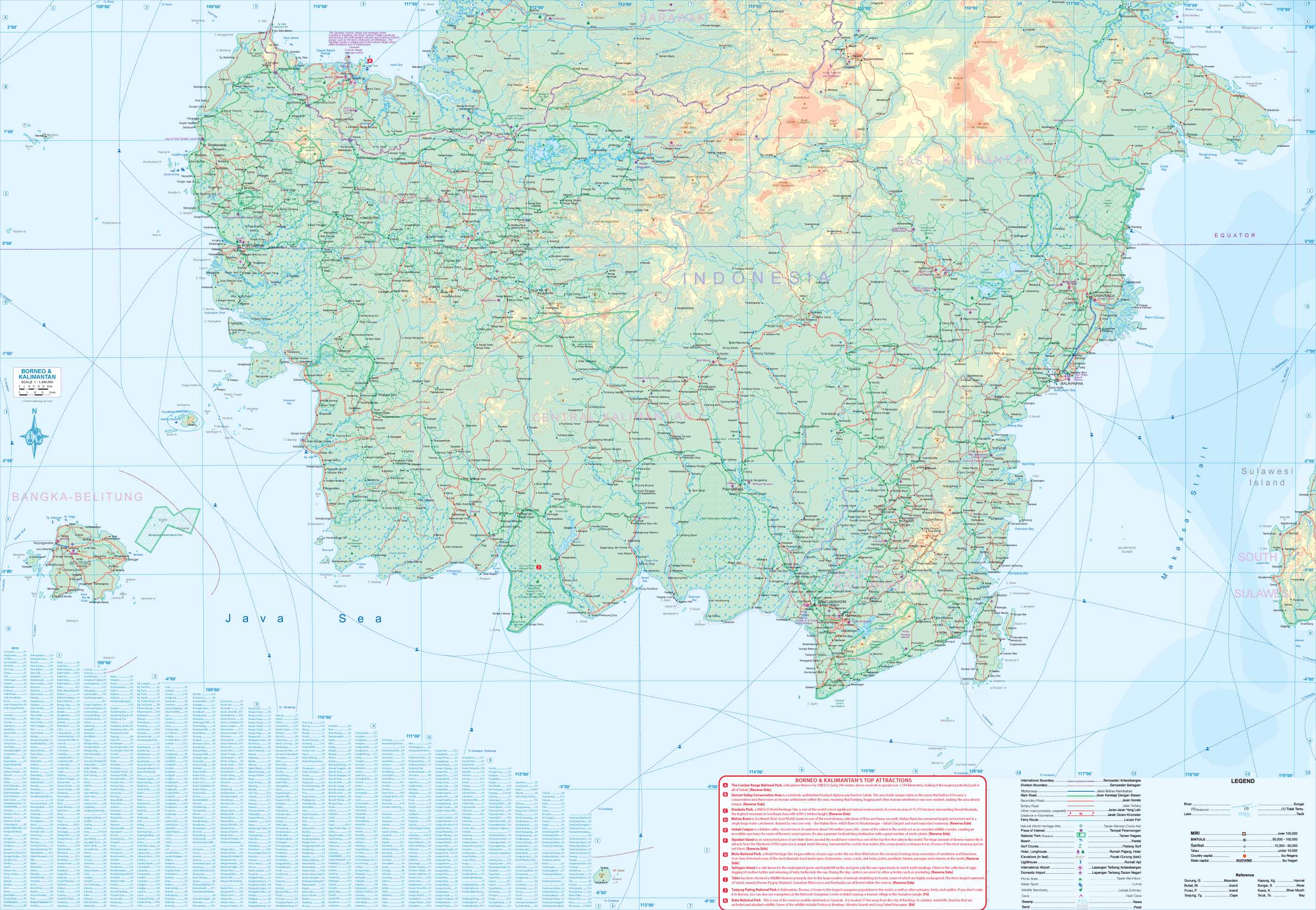

Sarawak S Pan Borneo Highway Guide PanBorneo 03 . Sabah Tourism Board Rebrands To Feel Sabah North Borneo Travelogue Sabah Map . Mapa Borneo 2025 Regiones Parques Nacionales Mapa. Maps For Travel City Maps Road Maps Guides Globes Topographic Maps Borneo Back . Tentang Borneo Kepulauan Ketiga Terbesar Di Dunia Terbesar Di Asia Peta Borneo 920x1024